Being good at fishing in Louisiana means understanding the lay of the land, how things once were and why they came to be.
I talk to a lot of people about inshore fishing
It's what I do. I get to hear their successes, failures, passions and fears.
A real concern:
Most inshore anglers fear accidentally running aground in their boat.
For me, the concern is somewhat trivial; my boat is relatively slow when cruising at 23-25mph.
If I do hit something, it's really not that bad.
It's not the same as hitting something at 50, 60 or even 70mph. At those speeds running aground can be catastrophic.
Also, because I run an aluminum flatboat, she can run "skinny" water with ease to bang that U-turn before it gets worse.
Not to mention I'm a grown, red-blooded American man. I have run my boat clean onto sandbars and into mud.
Pulling her out with my own strength isn't incredibly difficult. Mishaps here and there are affordable.
Being 31 helps, too.
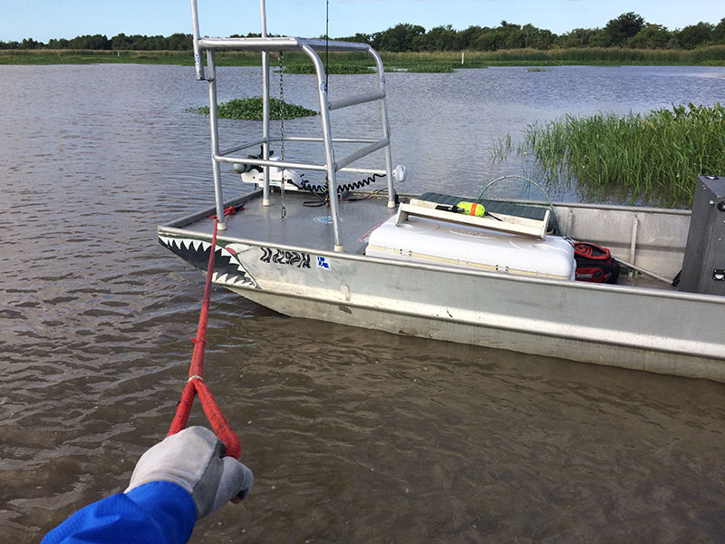
I love challenges, but these are not for everyone.
However, some people aren't 31.
That and most run boats much heavier than mine. Last but not least, not everyone wants to jump in the water!
There's all kinds of crazy critters from alligators to sharks to stingrays.
Not to mention that evil flesh-eating bacteria.
Note on being stung by stingrays... Being stung by a stingray was one of the more painful things I have experienced. In the event it ever happens to you (and I hope it doesn't) you can refer to this article on how to stop stingray pain.
So Why is Delacroix so Shallow?
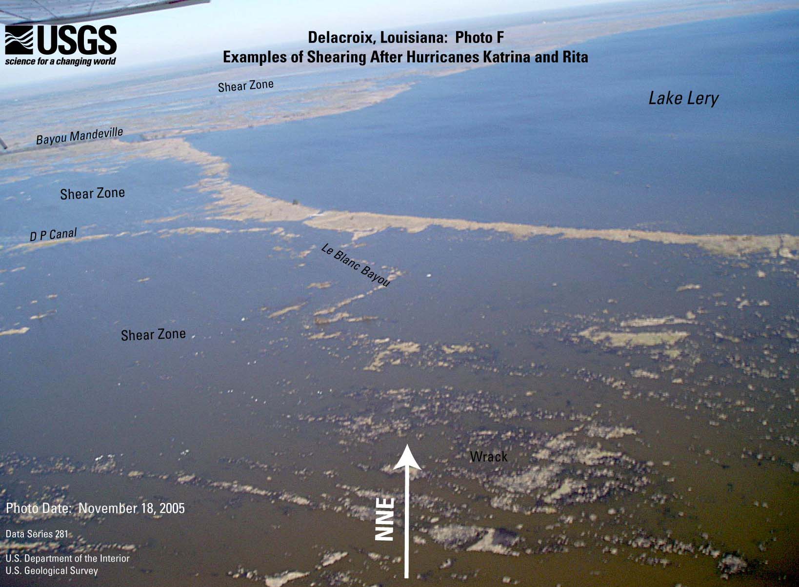
Photo Courtesy of USGS. This photo reveals the aftermath of Katrina.
Louisiana's coastal marshes are rife with shallow water, but it seems that Delacroix comes up the most. As it should!
This is because Delacroix went through a catastrophic makeover during Katrina. The marsh from Bayou Terre aux Boeufs to the Mississippi River suffered in a way other marshes did not.
When Hurricane Katrina rolled through in 2005, she relocated vast swaths of the marsh. Quite literally, a layer of topsoil and grass was rolled up like a carpet and thrown down somewhere else, where it died.
This ripped-up grass is referred to as "marsh wrack".
You can also see the difference between the Delacroix marsh before and after Katrina in this video I made awhile back.
How does this affect navigating Delacroix?
If it's not already obvious, the hazard lies within water that deceivingly looks deep enough to run your boat in.
The boundaries of navigable bodies of water are no longer easily seen by a shoreline.
It is really easy to make a wrong turn and run into shallow water that used to be land.
How do we adapt to this change?
I have a trick up my sleeve. Break out your computer because it's....
...Time to get technical
Nothing beats experience, but there is a solution you can use. This solution is great because it works even if you have never been to Delacroix!
The key is historical imagery in Google Earth.
In case you're not familiar with it, Google Earth is an excellent tool for exploring and navigating the marsh. I highly recommend you read my article on how to create custom GPS routes.
NOTE I have to point out the difference between the smartphone app and the computer program.
While they have the same name, only the computer program has the functionality needed to create custom GPS routes and view historical imagery.
Engage the Flux Capacitor
With Google Earth you can "go back in time" to view satellite imagery of the past. This way we can see where the actual shoreline is and create routes based on that information.
Then you can follow that route to give you a baseline as to what is navigable and what is not.
Lets solve this simple navigational problem
How do we get from Sweetwater Marina to Little Lake?
Seeing so much of the land around Bayou Gentilly was converted to open, shallow water by hurricanes there is a good chance someone who is new to the area may run aground.
Note: The screenshot depicted here is a screenshot of the Google Earth program, just in case you have never seen it.
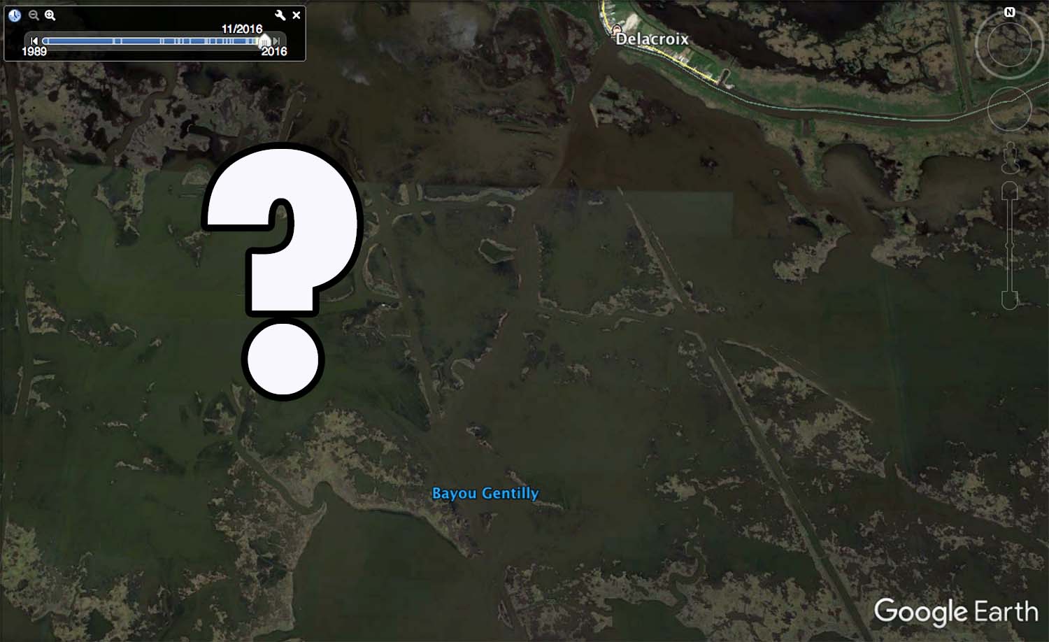
The marina is where you see "Delacroix" printed on the map. Little Lake is the open body of water just southwest of where "Bayou Gentilly" is printed.
This is an easy problem to solve. In Google Earth I can roll back to 1999, well before Hurricane Katrina struck.
There I can see the actual shoreline of Bayou Gentilly and create a route to navigate my boat with.
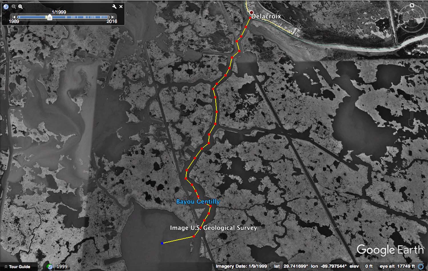
Now I can scroll back to the most recent satellite imagery and see where it is I must drive my boat to avoid getting stuck.
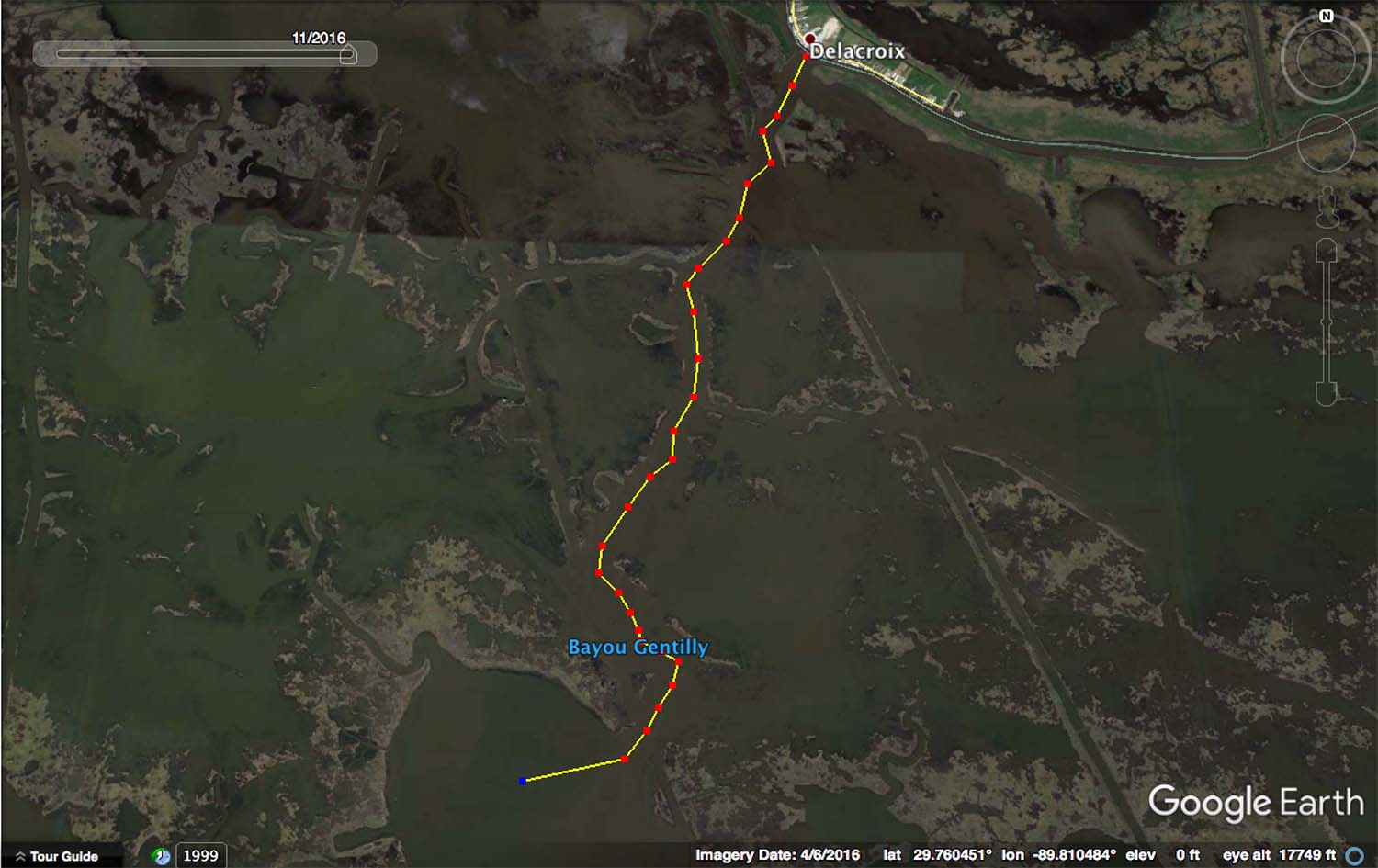
Using the Custom Route Tutorial I linked to earlier, I can take this route off of Google Earth and upload it into my GPS. Then I am ready to rock and roll!
Pretty slick, huh?
Now read this
This trick works in other places that also have shallow water due to hurricane damage. However, it's not completely fool-proof.
It's still up to you to take responsibility for yourself and anyone riding with you. Honestly, it's best to go slow in new areas. Use common sense and be cautious.
This isn't bowling. It's inshore fishing.
There are no gutter guards and you can't reset the game if things go awry.
One Last Thing
This is only one of many ways I use Google Earth to my advantage.
There's more this resource has to offer! That knowledge is what I teach in my class, Inshore Fishing 101.
One Last Thing
This is only one of many ways I use Google Earth to my advantage.
There's more this resource has to offer! That knowledge is what I teach in my class, Inshore Fishing 101.

Sorry to hear that, Rydell.
Use what’s in this blog post and you’ll avoid those problems in the future.
Tight lines
I got lose in Delacroix last Sunday for two hour in the mud it was bad i jump in the water it about 3ft deep but the mud was 4ft i was scared as hell