Where will you go to find specks and reds this spring? Before you answer, consider this easily fishable hot spot.I love fishing the MRGO, especially south of the Rock Dam in Hopedale.
But for whatever reason, I watch anglers rocket right past it.
What is the MRGO?
It's short for Mississippi River Gulf Outlet.
Also known as the "Mr. GO", it is a large canal that was dug through the marshes of St. Bernard Parish in Louisiana during the 1950s.
Its purpose was supposed to serve as a shortcut to New Orleans for cargo ships but it was rarely used.
A disaster on an economic and ecological scale, the gargantuan canal permanently transformed the landscape of the surrounding area.
Eventually it was closed off by a giant rock dam after Hurricane Katrina struck in 2005. Despite all of its shortcomings and controversy nobody has ever pegged the MRGO as a good place to go fishing.
This area is not just a great spot to fish, but is also strategically located for the spring and summer fishing patterns.
What makes the MRGO good for fishing?
There are several things that makes this hot spot stand out:
- deeper than the surrounding area
- parallel shorelines
- unique shoreline types
- consistent bait
- easily accessed
Unique Structured Bottom
The MRGO was meant to accommodate huge ocean-going ships, so it was dug pretty deep, over 40ft in some places.
Edges of the canal have eroded over the decades, creating flats with drop-offs, or ledges.
This kind of structured bottom is great for fishing. You can literally cast on one side for redfish and the other for speckled trout.
That's exactly what I resorted to on this fishing charter: How "Plan Redfish" saved this bad trout trip.(click)
Redfish love the shallow flats and shoreline while the trout hang around the ledge.
Know that the drop off isn't going to be right at the shoreline, but a little off of it. A lot of the MRGO shoreline is shallow, creating something like a flat, before it deepens a little and then finally drops off into the channel.
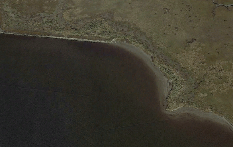
You can see where the shallow shoreline is in this Google Earth picture,
Plenty of Bait
This deep water provides a hideout for baitfish like shrimp and pogies.
In fact, it is normal to see shrimp boats dragging nets in this area because there is such an abundance of bait there. Even right outside Campo's Marina, on the north side of the Rock Dam, one can see shrimp boats plying their trade.
Clean Water
It is not uncommon for the south side of the Rock Dam to be the cleanest because the MRGO provides a straight shot of clean saltwater into the marsh. You can see this on Google Earth plain as day.
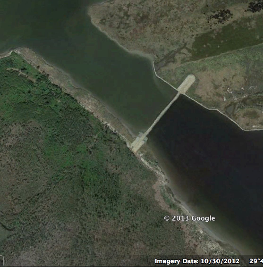
Note how the water is different colors on each side of the Rock Dam. This is because the south side has clean water since it is protected. Harsh north winds were blowing the day this image was taken.
Different Shorelines
There are several types of shorelines in the MRGO and they are all good to fish. There are:
- rock piles
- shell beaches
- grassy shorelines
Some shorelines only have oyster grass (also known as spartina grass) while others have roseau cane. Having the diversity in shoreline types gives you options.
For example, when water levels get low, the aforementioned flats drain out. As a result, redfish follow the water and end up on nearby rock piles.
As soon as you come out of Bayou Pisana and turn left into the MRGO you will see these rocks going down the shoreline. They are good for black drum and sheepshead, too.
Conversely, when the water is high you will find redfish in flooded grass on the shoreline. I go into detail on this in Where I've Been Fishing For Limits.
MRGO Short/Long Rocks
The rock piles I mentioned are not the same as the "rocks" referred to for the May speckled trout bite. Also known as the Short Rocks and Long Rocks, these locations are a hotspot during the spring and summer pattern.
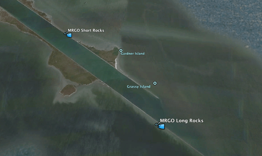
These are the spots people are referring to when they talk about the Long and Short Rocks
I have done best here in May and June using live bait or artificial lures.
However, be warned that the MRGO Long Rocks is not a secret fishing spot! It is well known and everyone knows this spot turns on during the spring. It can become ridiculously crowded.
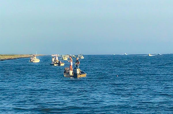
Now you see another reason why you should know how to fish the rest of the MRGO.
A Good Shoreline for a Bad Wind
Because it has parallel shorelines the MRGO is an excellent place to hide from the wind. If it is windy on one side and the water is dirty then you can shoot to the opposite side and have better luck.
This tactic saved my fishing charters in June 2012. Strong 15 - 25 knot winds were blowing from the east, keeping me out of Breton Sound, where the majority of trout were located for the spawn.
A lot of people were foregoing fishing, but I was in the MRGO making the best of it for my customers!
It is important to note the southern/western shoreline is built higher. This is due to the Army Corps of Engineers dumping dredge material there during construction of the MRGO.
It's basically a cliff protecting the shoreline from a southwest wind. You can find lee water there when the conditions aren't that great. I have used this to my advantage, successfully catching specks, reds and sheepshead.
It's Where Everything Flows
When water levels drop, they drop to the MRGO. Clean water and baitfish will flow there first with speckled trout and redfish right behind them.
It is not uncommon to see birds diving in the MRGO nor is it unusual to see long streams of pogies and mullet flowing with the current down a shoreline.
Knowledge Bomb
Remember how deep the MRGO is. No matter how low the water gets, you will always be able to draft your boat there.
Seek Shelter
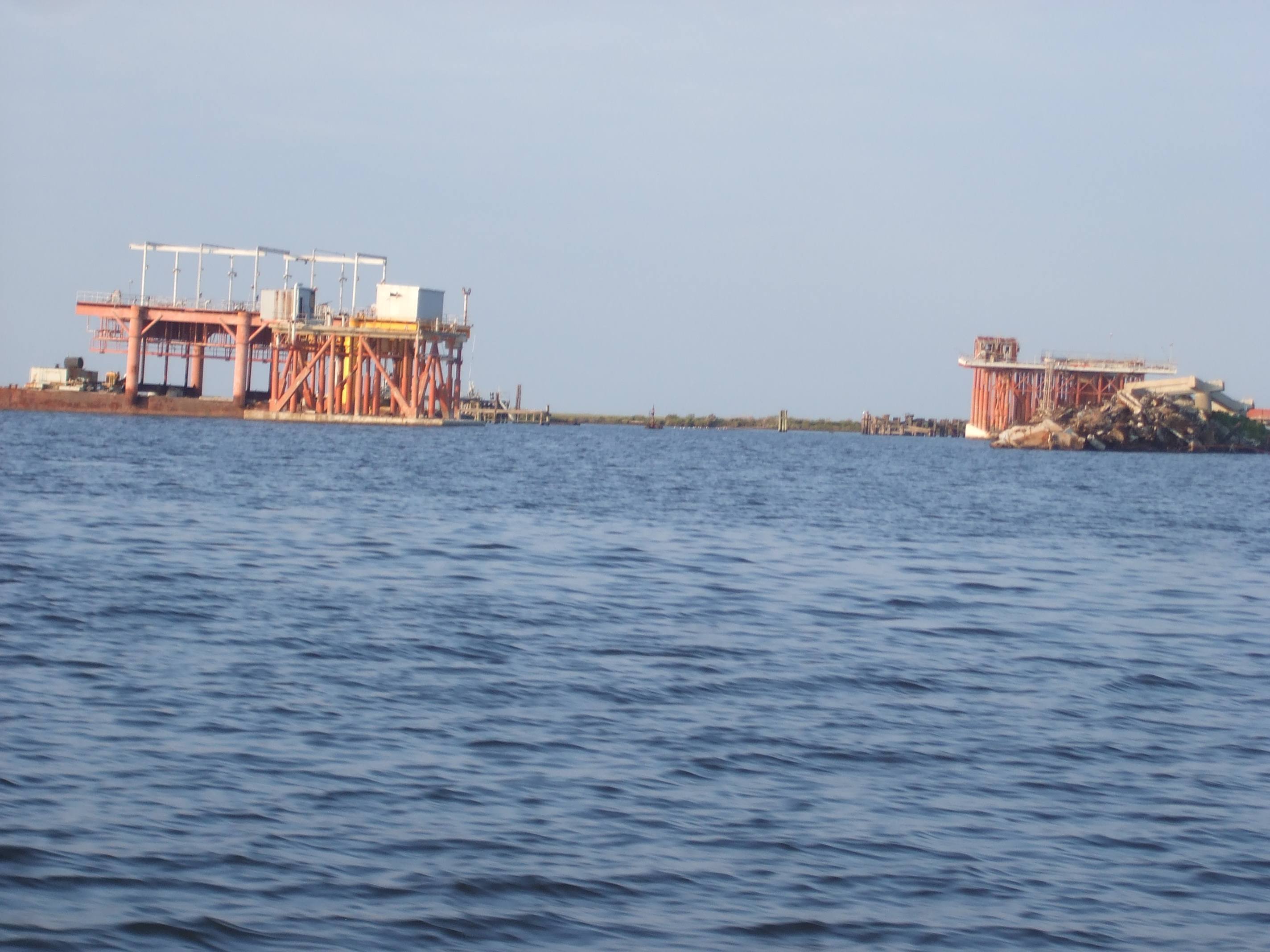
This gas platform and debris pile mark a canal that is a good place to hide from storms. The debris pile can be good to fish, too.
There is a canal off the channel that has a debris pile and "dead" gas platform. This canal serves as an excellent place to hide when summer squalls approach. You can get out of the wind and even step onto hard ground by the debris pile.
Summary
The MRGO south of the Rock Dam is a great fishing spot! It offers many advantages that other areas do not. You can read fishing reports so you know if this area is on fire or just doing "okay".
Register at Louisiana Fishing Reports and don't be shy to give back to the community by posting a report.

Hey Martin, that answer to that question is YES.
I strongly suggest you check out LAFB Elite’s Community for fishing reports, as this topic has been covered many times.
There are plenty of places to fish from land in Lacombe and even Hwy 23 down by Port Sulphur.
Is there any areas this way where you can fish from land (I don’t own a boat) :(
Hey Harry, I don’t have coordinates ready for you, but if you use satellite imagery (and who doesn’t?) it’s very easy to find about halfway down on the south shore. Tight lines!
Need reference points on chart for debris pile