Find any lake or bayou using this simple trick, so you know exactly where to go fishing and how to get there.
How many times has it happened that someone mentioned a body of water they caught a nice box of fish in, but you had no idea where it is?
Don't feel bad! Even veteran anglers encounter this frustration from time to time.
Why?
Because Louisiana's marsh is simply that big.
I know it happens and, when it inevitably does, I'll refer to Google Earth to show me the way.
How To Find Any Lake Or Bayou Using Google Earth
It's easy to find any lake or bayou when you use this powerful computer program.
I'll show you how shortly, but just in case you never heard of Google Earth...
Why Google Earth?
Inshore anglers who have followed this blog for awhile know that I am bananas for Google Earth.
Satellite imagery is a powerful tool I learned to use while in the military, and in the years since have brought those skills to inshore fishing.
Not only do I love this bird's eye view, but I also love sharing how with inshore anglers wanting to learn that knowledge.
There's just so much Google Earth can do when it comes to safely navigating the marsh and finding fishing spots:
By now you're probably thinking, "What about Google Maps?"
The answer is that Google Maps doesn't work as well as Google Earth, and are totally different tools, though they appear similar on the surface.
Need more detail? This video from Inshore Fishing 101 shows more.
Where can you get Google Earth?
Here are the relevant links for downloading, installing and sourcing technical help:
Now that we've cleared that up, let's move on to the good stuff!
Step By Step Process to Find Any Lake Or Bayou
Once you have Google Earth ready to rock 'n' roll, follow the steps below to find any lake or bayou from scratch.
Step 1 - Locate the Search Box
Whether you're using a Mac or PC, you will see the search box in the upper left hand corner of the screen.
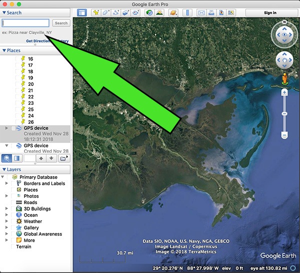
It will look like this:
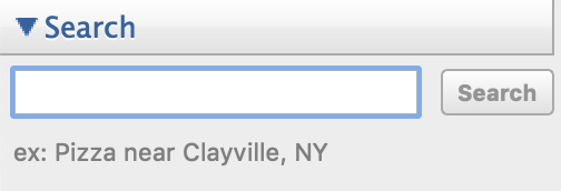
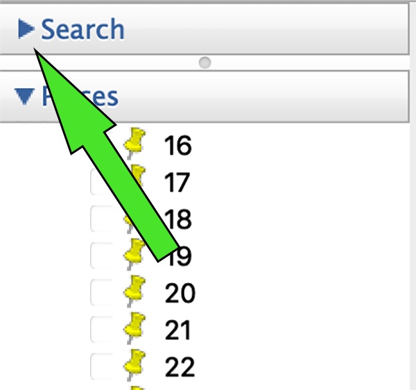
Don't see the search box?
You may need to hit the arrow to the left of "Search" in order to explode the search pane.
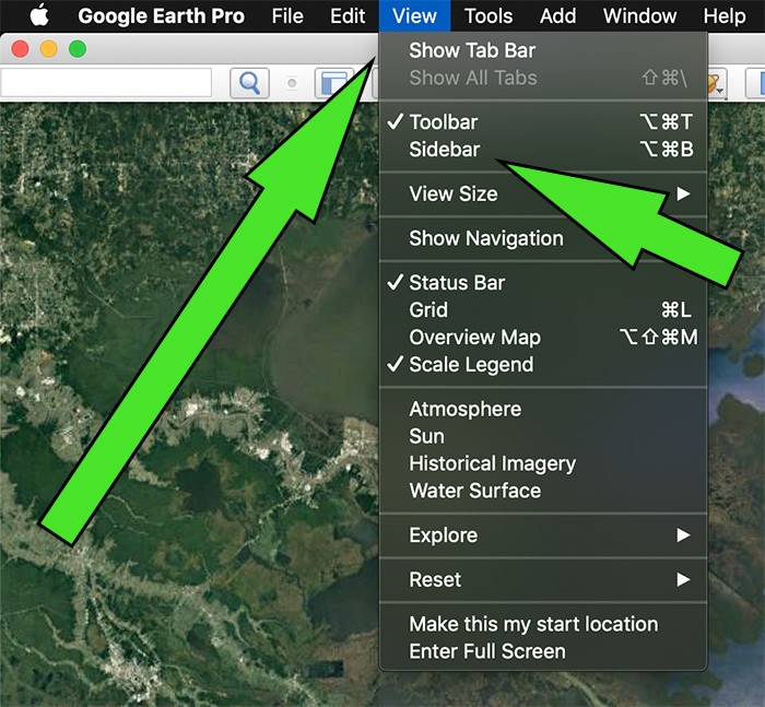
If you don't see it at all, then you need to enable the sidebar.
It's available under View -> Sidebar, or just refer to the screenshot below.
Step 2 - Enter Search Criteria
Punch in whatever name you saw in a fishing report, or heard in conversation.
Google Earth will auto-suggest places you may be looking for.
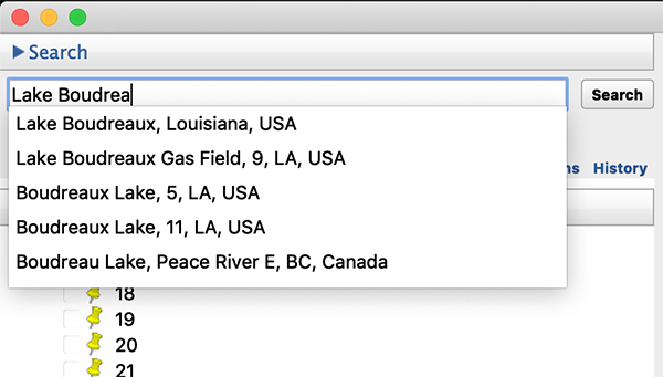
As you can see, more than a few results for "Lake Boudreaux" cropped up before typing could be completed.
This is fine, just choose the one that matches what you're looking for.
Step 3 - Google Earth Marks The Spot
Once you choose a search result Google Earth will mark the location with a red pin.
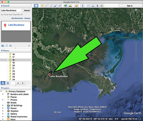
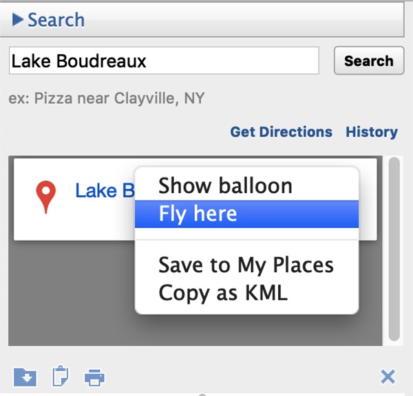
You can right-click the result and hit "Fly Here" to zoom in right away.
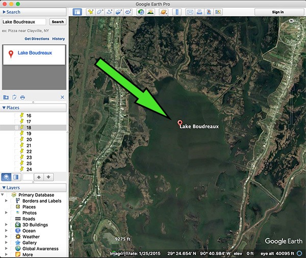
Google Earth will automatically zoom to your result, and you may begin exploring this new fishing location.
What if it's a common name?
Louisiana has a lot of marsh, and many bodies of water were named the same thing.
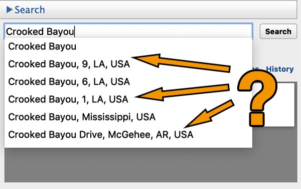
Common names you'll run into are:
- Crooked Bayou
- Redfish Point
- Little Lake
- Mud Lake
- and more..
When this happens I suggest you narrow it down to a general area, say Hopedale, Cocodrie or wherever.
It also helps if you can get clarification from the source you heard it from, or a body of water near that one to help better locate it.
Summary
It could be easier to ask someone, but the best inshore anglers are self-reliant and make use of tools available to them, especially to find any lake or bayou.
Google Earth fits that bill, and is an incredible resource for those inshore anglers willing to use it.
Yes, it does require a computer, but you should know the public library is free and has better equipment than you'd think!
Hope y'all found this blog post helpful and, if there's anything you'd like to add (or simply want to ask a question) then post a comment below.
Tight lines, y'all!

Much thanks!
Devin,
This is one of the best introductory videos you’ve done, especially enticing for those who don’t yet know you and what you do. Great job!
RodFather